World 🢖 South America 🢖 Venezuela
Sinkholes 🢔 Caves 🢔 Geological wonders 🢔 Categories of wonders
Wonder
Sima Humboldt and Sima Martel
 In short
On the top of the grim, forest covered mountain, in a cave, there is living Evil Spirit, hunting for humans. Sometimes he is heard devouring human flesh and then a terrible sound “Sari… sari…” is heard…
 55.5%
55.5%
GPS coordinates
Location, address
Depth
Map of the site
If you see this after your page is loaded completely, leafletJS files are missing.
 In detail
The legends of Ye’kuana Indians gave the name to Sarisariñama tepui (1, 2) – a spectacular, forested table-top mountain in one of the most remote areas in South America – south-eastern Venezuela.
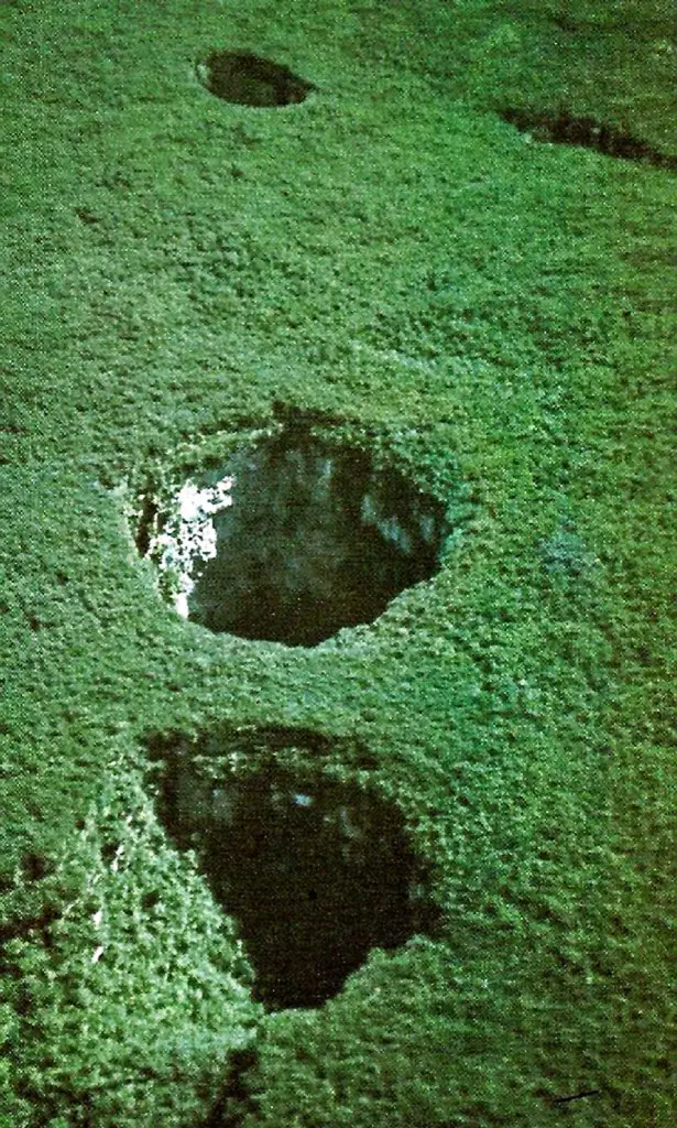
It was only on November 25, 1961 (3) that a famous jungle pilot Harry Gibson happened to fly over this mysterious mountain and spotted something unusual – a carpet of beautiful green forest that was perforated by two enormous and apparently very deep holes – each having a patch of forest at their bottoms.
In the fantasies of many people this unusual natural phenomenon promised exciting discoveries – maybe prehistoric animals still are living there?
Forested tepui
Sarisariñama tepui is located in the middle of a primeval forest with the closest road being hundreds of kilometers away. There are more than 100 tepuis (very impressive table-top mountains) in the southern parts of Venezuela and Guiana as well as in the bordering regions of Brazil. Tepuis consist of pink, arenitic Paleoproterozoic sandstone (quartzite) of Roraima formation and belong to the oldest exposed formations on Earth. Their age is approximately 1.8 billion years (4).
The summit area of Sarisariñama tepui is 546.88 km² and its slope area is 482 km² (5).
Most tepuis do not have forest on their tops but in this respect Sarisariñama tepui is not typical. The jungle on the top of this tepui is so dense that one can pass within 50 meters of the rim of both sinkholes, without noticing them.
In general tepuis in the eastern part of Guiana Highlands have some sparse and low forests and are comparatively poor in species diversity, but Sarisariñama tepui is an exception, having 15 – 25 meters high trees and being rich with varied species (5).
In total Sarisariñama tepui has got four biotopes represented (5):
- Tall, upland scrub on rock
- Tubiform, shrubby highland meadows on rock and peat
- Medium, evergreen upper-montane forest
- Medium, evergreen montane forest
Sarisariñama tepui is characterized by endemic species such as the frog Stefania riae Duellman&Hoogmoed, 1984.
First explorers – Indiana Jones-style adventurers
We know too little about the history of Indians in South America and can not be sure whether they have ascended the mountain and reached the sinkholes in the past.
The modern world had to wait for 1961 and a jungle pilot named Harry Gibson to spot both sinkholes or simas as they are called in South America.
The announcement made by Harry Gibson about the weird formations in Sarisariñama tepui was well-known among specialists and adventurers. But walking hundreds of kilometers through the impenetrable jungle to reach the base of Sarisariñama (one Norwegian expedition (2) in the 1990s made only 300 meters a day through this jungle), ascending many hundreds of meters of steep cliffs, going through the jungle again, and descending to an unknown depth required strong will, organizational and managerial capabilities and… a lot of money.
Only in 1974 was the first expedition to these sinkholes organized by explorers and adventurers David Nott and Charles Brewer-Carias, involving numerous specialists who used this lifetime opportunity to be the first in an unexplored area.
The expedition used a helicopter and thus did not have to spend too much time and effort to reach the summit of Sarisariñama. Groups of people were released into the jungle next to the largest sinkhole and three men descended on 7 ropes tied together, each 50 meters long.
As they descended, they realized that getting back was not going to be easy because the sinkhole down below was wider than above and the rope was hanging free. Thus explorers were in a trap, like bugs in a jar. During the next few days, a winch was arranged and a chainsaw and other supplies were lowered. The three men made a desperate attempt to cut giant trees to make an open space for the helicopter, living with the unpleasant exhaust of the chainsaw. This slaughter of unknown and most likely, very rare species of plants was unnecessary, as, in the end, they used cable ladders to get out of their trap.
During their stay the expedition looked for the underground river which had formed the sinkhole, but was without success: there was no water body below.
More thorough investigation of both sinkholes was done two years later, in 1976 by a joint Venezuelan – Polish expedition. They discovered one more sinkhole, Sima de la Lluvia. For some two decades, it was the longest known quartzite cave (1.35 km) in the world and its exploration to a great extent solved the mystery of the formation of these sinkholes. In total there are four sinkholes known in Sarisariñama.
Sima Humboldt and Sima Martel
After some controversies, both sinkholes were named by a participant of the expedition from 1974, Eugenio de Bellard Pietri in the noble names of the explorer Alexander von Humboldt and the legendary speleologist Eduard Martel – Sima Humboldt and Sima Martel. Often the simpler names are used instead: Sima Major (Large Sinkhole) and Sima Menor (Small Sinkhole).
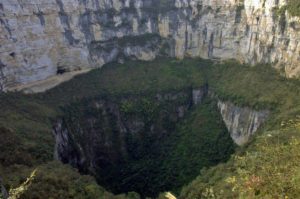
Sima Humboldt or Sima Major is the largest one. Its depth is 314 meters, with a volume of 21 million cubic meters. At the upper rim, the sinkhole is a maximum of 352 meters wide, but down below is up to 502 meters wide (7).
Sima Menor or Sima Martel is 248 metres deep.
Both sinkholes are roughly circular in form, but not exactly round. The distance between the rims of both sinkholes is approximately 700 m.
Sima Menor contains stalactites of exotic black mineral called litiophorite. In both sinkholes, there are small stalactites, mats, and coralloids of opal. The formation of opal has been initiated by bacteriological processes (8). In Sima Humboldt, one can find gypsum crusts as well.
The vertical walls of both sinkholes have been insurmountable to plants and animals living on the bottom of both wells. Thus, over a long time, there has developed a unique, small ecosystem with such species of plants and animals which are found nowhere else on Earth.
It takes some hundred million years and a bit of water…
Sarisariñama is not the only place having such sinkholes: there are similar formations in nearby tepuis; such as the breathtaking and deeper Sima Aonda on Auyán Tepui. Such sinkholes have formed through the following steps:
- Gradual chemical and mechanical erosion of the hard quartzite along the fissures;
- Formation of voids;
- When the area of voids increases and the ceiling becomes unstable: a subsequent collapse of the ceiling until the surface of tepui has been reached.
Both of the Sarisariñama sinkholes are located close to the rim of a tepui and there is not much doubt that here the process has been the same. This process has been very slow and a large stream was not needed to create these giant holes (9).
Such processes are unusual because the quartzite forming tepuis is impermeable and with exceptional resistance against water erosion. But tepuis belong to the oldest mountain formations in the world and here time is measured in many hundred million years. The sinkholes of Sarisariñama tell us: if there is enough time, water finds its way through the hardest rock.
The geological processes in the Sarisariñama tepui resemble karst processes in many respects, which are typical for the much softer and more soluble rocks like limestone and dolomite, but are a lot rarer and take a lot more time.
Living legend
The legend about the Evil Spirit is alive up to this day and many Indians still are afraid of the jungle-covered tepui.
The entire Sarisariñama tepui and surrounding areas are included in Jaua-Sarisariñama National Park and the tepui is off-limits to general tourists. Only researchers may get a permit to visit this unusual location: the unique nature of this site is too unique to afford the risks created by tourism.
But it is also true that visits to this unusual site are offered by some adventure tourism companies – Wondermondo is not sure who is cheating whom here.
Myths and truth
A wish to experience sensation and the “copy&paste” culture has created some myths about the sinkholes of Sarisariñama tepui. It is about time to dispel some of them:
- Sinkholes of Sarisariñama are the largest/ deepest in the world. Not true: for example, Abismo Guy Collet in Brasil is even 671 meters deep and the Sima Aonda (Venezuela) is 383 meters deep.
- Both sinkholes are perfectly round. Not true: both Sima Humboldt and Sima Martel are elongated and not even in form.
- Mechanism of the formation of these sinkholes is a total mystery to scientists. Not true: it has been pretty clear since the expedition in 1976.
- Sinkholes were discovered only in 1974. Not true: they were discovered in 1961 and first accessed in 1974.
References
- Lindsay Elms. Mount Roraima: An Island Forgotten by Time.
- Travel Explorations. Norwegians returned alive from the Devil’s Cave., 2003-12-18.
- Otto Huber and John J. Wurdack. History of Botanical Exploration in Territorio Federal Amazonas, Venezuela. Smithsonian Institution Press, City of Washington, 1984.
- João Orestes Schneider Santos, Paul Edwin Potter, Nélson Joaquim Reis, Léo Afraneo Hartmann, Ian Robert Fletcher and Neal J. McNaughton. Age, source, and regional stratigraphy of the Roraima Supergroup and Roraima-like outliers in northern South America based on U-Pb geochronology. GSA Bulletin; March 2003; v. 115; no. 3; p. 331-348. Link
- Roy W. McDiarmid and Maureen A. Donnelly. The Herpetofauna of the Guayana Highlands: Amphibians and Reptiles of the Lost World. University of Chicago Press, 2005.
- The Making of the Tepuis Film: "The Living Edens: The Lost World".
- Miguel Lentino, Diana Esclasans: Áreas Importantes Para La Conservación De Las Aves En Venezuela In: BirdLife International y Conservation International. Áreas Importantes para la Conservación de las Aves en los Andes Tropicales: sitios prioritarios para la conservación de la biodiversidad., Quito, Ecuador: BirdLife International (Serie de Conservación de BirdLife No. 14), S. 621-730, 2005.
- Franco Urbani (2009) Venezuelan Cave Minerals: Second Review. Mineralogy 1 2009 ICS Proceedings. In 15th International Congress of Speleology. p 345.
- Zhu Xuewen and Waltham Tony. Tiankeng: definition and description. Speleogenesis and Evolution of Karst Aquifers. 2006.
Sima Humboldt and Sima Martel are included in the following lists and articles:
 Linked articles
Wonders of Venezuela
Venezuela is famous for its primeval, vast natural areas with numerous impressive natural monuments: such as the plateaus with abrupt walls (tepui) and numerous very impressive waterfalls, including the world’s highest one – Angel Falls. Extremely high biodiversity is characteristic of the entire country.
Sinkholes
This category includes outstanding sinkholes – large natural depressions or holes, which for most the part represent collapsed caves.
Ecosystems
Biotope is a rather small area with uniform environmental conditions and a specific community of life. Wondermondo describes biotopes and ecosystems which have striking looks, look very beautiful, or have other unusual characteristics.
 Recommended books

